Organicity's London dataset released
The OrganiCity EU project is coming to an end this March, and we are preparing to summarize the results of the last 3-4 months of experimentation. Magenta will attend the OrganiCity Workshop on 30th of March at Future Cities Catapult in London. In the meantime, at this link you can find a dataset containing all the data collected by our sensors in London from January 11th to March 23rd.
The .ZIP package contains the following files, in CSV format:
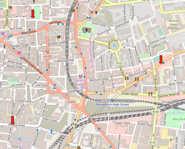
NewSpeakHouse_BethnalGreenRoad_eastbound.csv: vehicles driving in Bethnal Green Road, eastboundNewSpeakHouse_BethnalGreenRoad_westbound.csv: vehicles driving in Bethnal Green Road, westboundOpenDataInstitute_CliftonStreet_northbound.csv: vehicles driving in Clifton St., northboundOpenDataInstitute_CliftonStreet_southbound.csv: vehicles driving in Clifton St., southboundOpenDataInstitute_CliftonStreet_pedestrians.csv: pedestrians walking along Clifton St., both directionsOpenDataInstitute_WorshipStreet_eastbound.csv: vehicles driving in Worship St., eastboundOpenDataInstitute_WorshipStreet_westbound.csv: vehicles driving in Worship St., westboundOpenDataInstitute_WorshipStreet_pedestrians.csv: pedestrians walking along Worship St., both directionsUnit9_HoxtonSquare_south_westbound.csv: vehicles driving along the south side of Hoxton Square, heading westUnit9_HoxtonSquare_west_northbound.csv: vehicles driving along the west side of Hoxton Square, heading northUnit9_RufusStreet_northbound.csv: vehicles driving along Rufus Street, northbound (entering Hoxton Square)Unit9_HoxtonSquare_pedestrians.csv: pedestrians walking along the west side of Hoxton Square, both directions
The data are aggregated in bins of 15 minutes each. For each file, the first part of the name defines the place where the sensor was hosted, and that is useful to understand where this data was collected. For example, the passages in Bethnal Green Road were collected in front of NewSpeak House. Here’s a map of the revelant points: